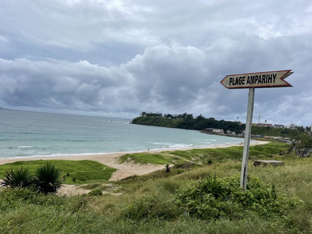
A view over Lake Amparihy in Fort Dauphin
Between the Mountains and the Sea
By Kass Wojcik
September 10, 2023
I knew Madagascar has mountains, but somehow, I hadn’t realized that there are mountains in the southeast, where I was heading to spend two months as a volunteer with SEED Madagascar’s Conservation and Research Program (SCRP) team. As my plane descended towards the town of Fort Dauphin—after a two-hour, white-knuckled flight south from Madagascar’s capital, Antananarivo—I was shocked to see that emerging from the clouds and curving away just inland of the soft blue lagoons dotting the coastline was a jutting mountain chain. They weren’t quite the Rockies, but they were tall enough to make you want to press your forehead against the glass and stare as they took shape below like the spine of some great beast that had fallen just short of reaching the Indian Ocean.
I had just spent the last 72 hours in transit and now I was finally on the last leg of my journey. After departing from JFK in New York City the day after New Years (could that be a more dramatic time to start a year of travel?), I landed in Nairobi, Kenya thirteen hours later. I spent a night in the city before flying to Antananarivo (more commonly referred to as Tana) the next morning, where I spent another night before then flying to Fort Dauphin the following day.
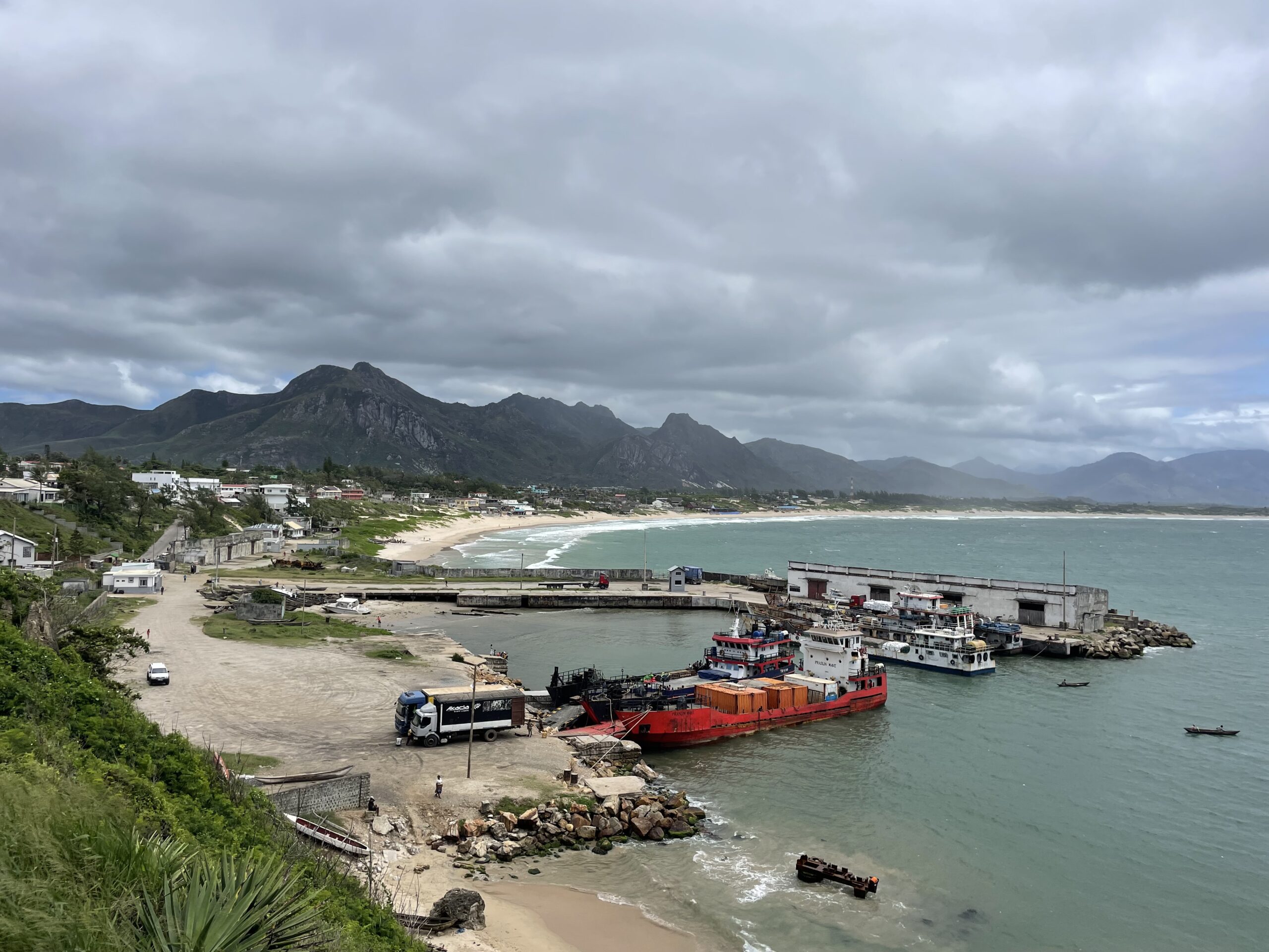
Madagascar is broken into twenty-two regions, and Fort Dauphin is the capital of the Anosy Region down in the very southeast corner of the country. Fort Dauphin is a port town on the edge of a peninsula that sticks out from the coast like the forked tongue of a snake. Despite the fact that it’s cushioned between sweeping mountains to the west and an endless curve of white sandy beach to the east, Fort Dauphin receives little tourist traffic due to its isolated nature. The roads to get there from the more frequently visited northeast and west are not the easiest or safest to travel, and there isn’t much tourist infrastructure once you do get there. This results in Fort Dauphin being a bit of a hidden gem, which I’ll talk about in a later post.

A view over Fort Dauphin’s harbor–if you kept following the beach beyond where it curves out of sight, you would eventually get to Sainte Luce
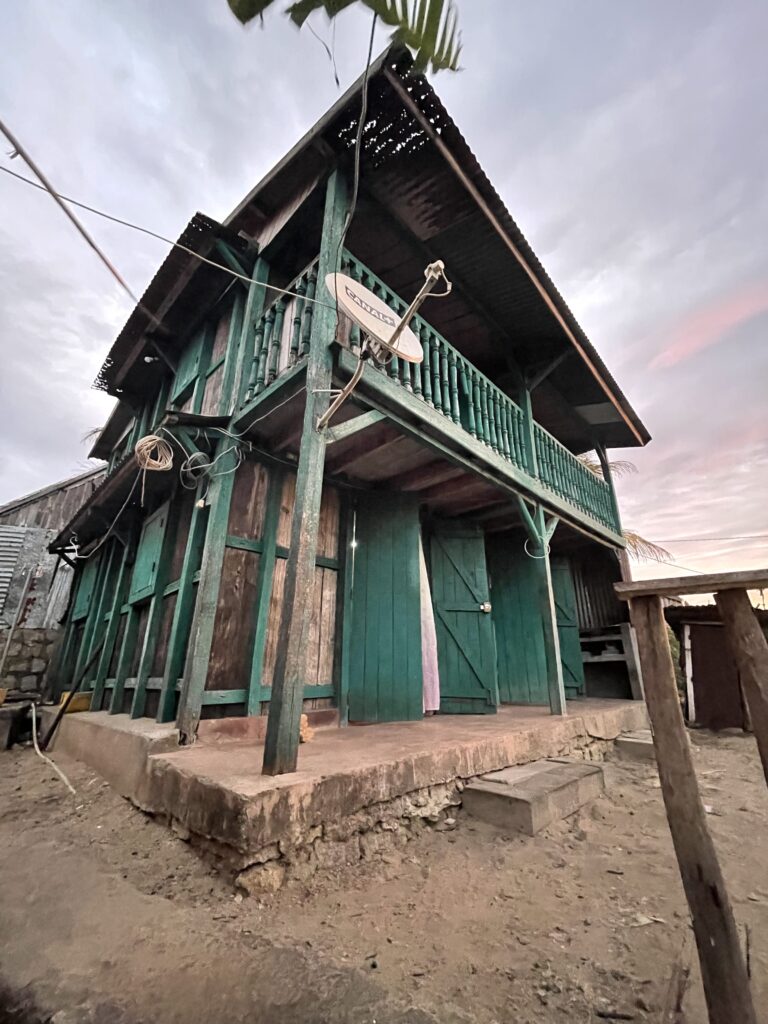
Fort Dauphin is the closest major town to Sainte Luce, which is where SCRP has their field camp and where I would be volunteering for the next few weeks. When I stayed in Fort Dauphin between our weeks at the field camp, I always stayed in the guesthouse of SEED’s Deputy Director, Tsina. It’s a lovey two-story teal colored house constructed largely of Ravenala madagascariensis, more commonly known as Traveler’s Palm. Traveler’s Palm has leaves that emerge from its stem like a fan and is Madagascar’s national symbol. It grows largely in wetlands and is frequently used for construction as it’s effective at keeping buildings cool. Tsina’s guesthouse sits on a hill overlooking the road and a wetland backed by some mountains that left me speechless when I arrived. After the rush of my travel days, I was glad to spend my first evening in Fort Dauphin sitting on the balcony outside of my bedroom watching the activity on the street wind down as the sun slowly sank behind the mountains.
The following day was in stark contrast to the night before, and consisted of a whirlwind of introductions to the SCRP team that I would be going out to the field camp in Sainte Luce with, followed by presentations on the work that we would be doing, a town tour, and some last-minute shopping.
Besides me, there were two other volunteers and five SCRP staff members who would be heading out to the Sainte Luce field camp. The two other volunteers were Tabea, from Germany, and Jordan, from Canada. Hoby, the SCRP team leader, was from a town in southwest Madagascar; Lewis, the Conservation Research Coordinator, and Tash and Jasmin, Senior Research Assistants were all from the UK; and our camp cook, Vaya, was from Fort Dauphin. When we got to camp, we would also meet up with the three SCRP guides, Solo, Raviza, and Babaly, who are all from Sainte Luce.
The eight of us were leaving for the Sainte Luce field camp the next day, which is about fifty bumpy kilometers Fort Dauphin. While there, we would be living and working out of the camp for about three weeks before then coming back to Fort Dauphin for a week break followed by another three weeks in the bush. Fort Dauphin is the nearest place to find a hospital and buy groceries beyond the snacks, drinks, and basic amenities you can find in the village shops in Sainte Luce. Fifty kilometers may not sound far, but the road is currently an unpaved track that winds through small villages and rolling bush, which means that the trip usually takes between two and three hours in a 4×4.
While in camp, we would be sleeping in tents, using long drop pit toilets, and taking bucket showers under the sky with water we pumped ourselves from a well. Three meals a day would be prepared by our wonderful camp cook, Vaya, and eaten under an open-air pavilion affectionately called “the Longhouse.” There would be one spot in camp and one spot a little down the road to get a few bars of service, and phones, laptops, and cameras could be charged in the tiny one room research center so long as the sun was out. Our work would involve long treks through forest and wetland every morning, afternoon, and evening to survey the various types of flora and fauna found in Sainte Luce’s ecosystems, and since it would be monsoon season while we were out there, those surveys would be hot, and there was a good chance that they would be rainy.
Altogether, these next few weeks were shaping up to have some of the most difficult and remote conditions that I had ever experienced. But that’s what made it all the more exciting to me. I had dreamed of doing this kind of field work since I knew what National Geographic was, and now I finally had the opportunity. All I could hope for was that it (and I) would live up to expectations.


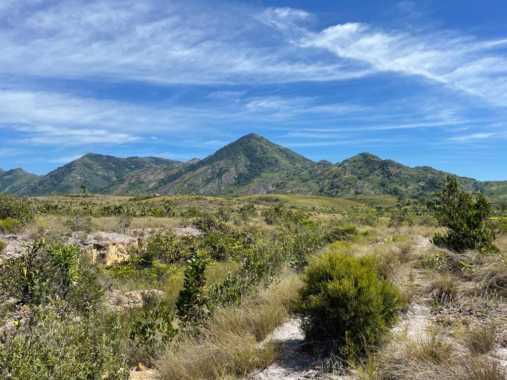
A beach in Fort Dauphin, scrubland backed by mountains on the way to camp, and Tsina’s guesthouse
We left for Sainte Luce the next morning in two battered 4x4s. They were stuffed to the gills with people and gear, and for most of the ride I found myself squished between Tabea and Jordan trying to balance myself on the middle-seat (that wasn’t quite a seat) while craning my neck to gaze at the scenery through the window.
Once out of Fort Dauphin, the road quickly turned to dirt and wound its way through trees, fields, and villages. The road was busy with people walking to where they needed to be and chatting with neighbors. About forty minutes in, the road widened dramatically between sides scarred and pitted by tree stumps, and the red dust kicked up, partially obscuring our view. A Chinese company is in the process of widening the road for a mining company operating in the area, and Lewis pointed out one of the operations as we passed. It looked like something out of a science fiction novel. Compacted red earth curved all the way out to the horizon and through the swirling dust, you could just make out big crawlers spitting out dark plumes. They’re sand mining for illeminite—a whitening agent used in paint and some toothpastes—which involves stripping all of the brush and forest in the area and combing the land with crawlers for minerals, which spit out the sand in the process. This area, Mandena, used to be forested just like Sainte Luce. Now it’s just a field of compacted soil. The vehicle was silent as we passed.
We passed through rice paddies where people toiled away and streams running down from deforested hills where women washed clothes while kids played in the water. We stopped at a check point where the vehicle was briefly checked for weapons before we moved on. The car that I was in was a bit further ahead, so we stopped in the town of Mahatalaky to stretch our legs. While much smaller than Fort Dauphin, Mahtalaky is a market town and larger than many of the surrounding villages. Someone bought a bunch of bananas from some women selling them on a table in front of their house and passed them around. They were only about the size of my middle finger and a little gritty but good. The other car arrived, and we piled back in for the last half hour of our trip.
I could feel a hot sleepiness descending as the dust and sweat tried to mix itself into clay on my sticky skin but just as my head was starting to nod forward, we rounded a bend, and my head jerked up.
Where before there was only a road hemmed in by steeply eroding dirt sides, now there was a rolling plain of scrubby trees open to the sky and backed by mountains that swept out to the horizon as far as the eye could see. A slight blue haze blurred the stubbled green chins of the mountains just enough that it seemed almost to blend the yellow-green scrubland with the endless sky above. As we made our way through deep puddles, over shaky wooden bridges, and around patches of trees that were gradually widening into fragments of deep green, I realized with mounting excitement, that this is where I would be living and working for the next few weeks.
After climbing one last sandy hill, we stopped next to a sunny little path that disappeared into the dark of the trees. At the end of that path, I was told, was the SCRP camp. Behind us were mountains, in front of us was the sea, and right where we were now, my new home. . .at least for the next few weeks.
